3 Haziran 2008 Salı

Ürgüp


Ürgüp

Ürgüp which has been established at the outskirts of the hill named as hill of whishes founded at 20 km in north of Nevsehir province in one of the first settlement areas of Cappadocia region. In the Byzantine period has been called as Osiana, Hagios, Prokopios, in the period of Seljuks as Bashisar and in the period of Ottomans as Burgut Castle. Until the first years of the Republic was called Ürgüp. Ürgüp was the patriarchate center of the Cappadocia region. The Üzümlü Church, Cambazli Church and Sarica Church in Ortahisar which was one of the villages of Ürgüp are the oldest rock churches from the region. Furthermore and Tavsanli Church and Church of Saint Basileious are the spectacular places. Ürgüp which has got the famous cave hotels, wines and hand made carpets is the most important tourism center of the Cappaddocia Region. The old cave houses were restored as a touristy cave hotel without damaging their historic structure. Among the cave hotels some of the cave have been restores as distraction place as discos and bars.

Cappadocia Balloon Tour

Balloon tour of Cappadocia Turkey
Cappadocia Balloon Tour

Everybody wants fly like a bird everytime. That is a big dream of human. Now you can realize your own dream with cappadocia balloon tour. Don't omit join to balloon tour if you planning to go to cappadocia. You can see the deep canyons, valleys and fairy chimneys from the air

Cappadocia balloon tour begins every day at sunrise. Balloon tour takes almost an hour but if you want to join deluxe balloon tour it takes 1.30 hour. There are so many balloon tour company in cappadocia area, you can choose one of them. You can take your own flight certificate after tour. Comfortable clothes and shoes are recommended.

Don't forget your own camera, because you can take the best photos of the world during that journey.

Have a nice journey.. I am sure that you will be enjoy in cappadocia and balloon tour.

Underground Cities
Kaymakli Underground City


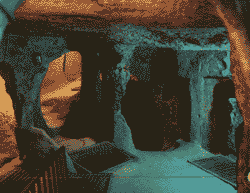
Certainly the most interesting features of the Cappadocia area are the underground cities founded within. Until now even that have been determined about 40 underground cities just six of these have been opened for visit. Nobody can know how many underground cities there are in the Cappadocia area. Some say that there is one for every village and settlement in the region but certainly not all of the sites can be described as cities. The first inhabitants of Cappadocia area have opened deep cavities within the volcanic rocks due to escape from the attacks of the wild animals and hard winter conditions and then they have enlarged these cavities according to their daily needs, they opened new cavities and created the underground cities connecting these cavities with tunnel and labyrinths. Later the underground cities were the place of the hiding of the first Christians who escaped from the persecution of the Roman soldiers and were enlarged to able when were necessary an entire city to live and every kind of fixture necessary for the living of the people has been attached. When there wasn't any danger the people living on the ground in case of the danger have hidden in the underground cities. For this reason all the homes at that time were connected to the underground cities with a tunnel.

The earliest record of the name of Cappadocia dates from the late 6th century BC when it appears in the trilingual inscriptions of two early Achaemenid kings, Darius I and Xerxes, as one of the countries (Old Persian dahyu-) which are part of the Persian Empire. In these lists of countries the Old Persian name is Katpatuka, but it is clearly not a native Persian word. The Elamite and Akkadian language versions of the inscriptions contain a similar name from Akkadian katpa "side" (cf. Heb katef) and a chief or ancestor's name, Tuka.[2]

Herodotus tells us that the name of the Cappadocians was applied to them by the Persians, while they were termed by the Greeks "Syrians" or "White Syrians" (Leucosyri). One of the Cappadocian tribes he mentions are the Moschoi, associated by Flavius Josephus with the biblical figure Meshech, son of Japheth, "and the Mosocheni were founded by Mosoch; now they are Cappadocians". AotJ I:6. Also see Ketubot 13:11 in the Mishna.

Cappadocia is also mentioned in the Biblical account given in the book of Acts 2:9, with the Cappadocians being named as one of the people groups hearing the Gospel account from Galileans in their own language on the day of Pentecost shortly after the resurrection of Jesus Christ. Acts 2:5 seems to suggest that the Cappadocians in this account were "God-fearing Jews". See Acts of the Apostles.

Under the later kings of the Persian Empire they were divided into two satrapies, or governments, with one comprising the central and inland portion, to which the name of Cappadocia continued to be applied by Greek geographers, while the other was called Pontus. This division had already come about before the time of Xenophon. As after the fall of the Persian government the two provinces continued to be separate, the distinction was perpetuated, and the name Cappadocia came to be restricted to the inland province (sometimes called Great Cappadocia), which alone will be the focus of this article.

The kingdom of Cappadocia was still in existence in the time of Strabo as a nominally independent state. Cilicia was the name given to the district in which Caesarea, the capital of the whole country, was situated. The only two cities of Cappadocia considered by Strabo to deserve that appellation were Caesarea (originally known as Mazaca) and Tyana, not far from the foot of the Taurus.

16 Mayıs 2008 Cuma

TTP Underground City

Cappadocians in popular culture

Trivia sections are discouraged under Wikipedia guidelines.
The article could be improved by integrating relevant items and removing inappropriate ones.

In The Simpsons episode "Brother from Another Series", the character Sideshow Bob grudgingly acknowledges the Cappadocians as the only "civilization in history [that] considered 'chief hydrological engineer' a calling". This referred to the Cappadocians being famous for underground cities, although not specifically dams.[7]

Dama the Cappadocian merchant is a major character in several early heroic fantasy stories set around the third century A.D. written by David Drake, Latin scholar and science fiction and fantasy author. The physical and temporal locale was a Roman frontier society in Asia Minor exposed to new conflicts with Christianity and continuing old conflicts with bandits and Persian invaders, where a merchant could experience exotic cultures and find occasion to demonstrate some skill with personal arms.[8]

Wu tang Affiliate Darryl Hill styles himself as "Cappadonna" in reference to this civilization and also goes by the pseudonym "Lebanon don" in reference to Lebanon being a part of this civilization.

In the popular role playing game series Vampire: The Masquerade, a fallen Clan of Vampires known as the Cappadocians played an integral part in the existence of the modern clan known as the Giovanni. Their relation to Cappadocia seems to be only titular and possibly geographical.

The Fairy Chimneys of Cappadocia are shown in the film The Stone Merchant.

In the computer game Rome: Total War, by The Creative Assembly, one can recruit a heavy cavalry unit called Cappadocian Cavalry, a Cataphract unit, but with weaker defence and attack, in comparison with the other Cataphracts (for example, the Armenian Cataphract).

Electronic musicians Autechre feature the Cappadocians on the cover of their second album, Amber.

15 Mayıs 2008 Perşembe

Cappadocia

The Cappadocian Region located in the center of the Anatolian Peninsula, with its valley, canyon, hills and unusual rock formation created as a result of the eroding rains and winds of thousands of years of the level, lava-covered plain located between the volcanic mountains Erciyes, Melendiz and Hasan as well as its troglodyte dwellings carved out of the rock and cities dug out into underground, presents an otherworldly appearance. The eruptions of these mountains which were active volcanoes in geological times lasted until 2 million years ago. A soft tuff layer was formed, 150 m in thickness, by the issuing lavas in the valley surrounded by mountains. The rivers, flood water running down the hillsides of valleys and strong winds eroded the geological formations consisting of tuff on the plateau formed with tuff layers, thus creating bizarre shapes called fairy Chimneys. These take on the names of mushroom shaped, pinnacled, capped and conic shaped formations. The prehistoric settlements of the area are Koskhoyuk (Kosk Mound) in Nigde, Aksaray Asikli Mound, Nevsehir Civelek cave and, in the southeast, Kultepe, Kanis and Alisar in the environs of Kayseri. This area with unusual topographic characteristics was regarded as sacred and called, in the Scythian/khatti language, as "Khepatukha" meaning "the Country of the People of the Chief God Hepat" The tablets called Cappadocian Tablets and the Hittite works of art in Alisar are of the important remains dating from 2000s B.C. After 1200s B.C., the Tabal principality, of the Khatti Branches of Scythians, became strong and founded the Kingdom of Tabal. Following the Late Hittite and Persian aras, the Cappadocian Kingdom was established in 332 B.C. During the Roman era the area served as a shelter for the early escaping Christians.

There are also several underground cities used by early Christians as hideouts in Cappadocia.

Cappadocia


Cappadocia

a view of the Fairy Chimneys in UchisarIt's name was probably derived from Katpatuka, land of the beautiful horses, in Hittite language. Cappadocia is generally regarded as the plains and the mountainous region of eastern central Anatolia around the upper and middle reaches of the river Kizilirmak (Red River). It was here that several ancient highways crossed and different cultures came into contact with each other. It was also the land of the Hittites. The sparsely inhabited landscape of Cappadocia is characterized by red sandstone and salt deposits of the Miocene (Tertiary) period. However, the relatively small areas of fertile soil on volcanic tuff is where the population tends to concentrate. This southern part of Cappadocia, the more densely populated, is often spoken of as the heart of the region and yet it lies in the extreme south-western corner. As well as cereals, Cappadocia is best known for potatoes, fruits and wine. Here you can taste some of the best examples of Turkish Cuisine.

The origins of this unusual region can be traced to the Tertiary period some 50million years ago, when craters and chimneys dominated the landscape. Since then huge quantities of volcanic material have spewed out of the many volcanoes. Forces of erosion have shaped the incredible and unique Cappadocian tuff-coned landscape. For hundreds of years men have dug into the soft but firm tuff to create dwellings, monasteries, churches and underground cities.

Fairy Chimneys under snow The history of Cappadocia began in prehistoric times. Hatti culture (2500-2000 BC.) had its way during the Bronze Age and in about the 2nd Millennium BC. the Hittites settled in the region. Soon the Assyrians (2000-1800 BC.) had established their trading posts. Phrygians probably ruled Cappadocia from 1250 BC., but the Lydians were expelled by the middle of the 6th century BC by the Persians who ruled until 334 BC. In AD 17 the region became a Roman province, trade and military routes were built and urban centers and settlements were encourage. Once Asia Minor came under Christian influence, the first Christian communities appeared in Cappadocia and those persecuted for their religious beliefs elsewhere sought refuge in the region. Cappadocia thus became a melting pot of a variety of ethnic groups, all of which have influenced the culture and religious beliefs. Basilius the Great (329-379 AD), bishop of Caesarea (modern day Kayseri), inspired many religious colonies and for a thousand years an active monastic way of life endured throughout Cappadocia. Invasions first from Turkmenistan and Mongolia and then from Seljuks and Ottomans put an end to the movement.

a frescoe from the Rock Churches There are many places to "must see" in Cappadocia like; Fairy Chimneys, Göreme Valley National Park and rock churches, underground cities of Kaymakli, Derinkuyu or Ozkonak, Zelve Valley and Pasabag, Avanos with its pottery and carpets, Uçhisar rock fortress, Ortahisar rock fortress, Ürgüp, Ihlara valley, Soganli, Sinasos and Hacibektas. In the summer (from May to November) several alternative tours can be arranged: Hot air balloon trip over the chimneys, trekking, walking, horse riding, motorbike or mountain biking around the valleys. For more information please contact Mr. Burak Sansal.

Please Click Here for Cappadocia Tours.


ADVENTURE...

Man originally conquered the skies with the hot � air balloon and the principle of lighter-than-air-travel.

This sensation in one of the most spectacular and beautiful areas in the world comes as one of life's unforgettable experiences. Kaili(English) and Lars(Swedish) will be your pilots in Cappadocia.

They have both been flying passenger balloons professionally in Europe and Turkey since 1980.

Languages spoken: English, Swedish, French and German.

INFORMATIONS


·Full payment upon confirmation

·Individual and group bookings

·Outdoor clothing and comfortable shoes are recommended

·Flights are operated by Kapadokya Balonculuk Tur. Tic. Ltd. Sti under " licence number "1997/18 issued by the Ministry of Transport

LIfestyle WalkInG TOUR

Enjoy a highly specialized ‘Lifestyle Walking Tour’ that takes you Travel Agent Cappadociainto traditional village family life of Central Cappadocia visiting local homes and rock-hewn villages and exploring many spectacular lesser-known valleys such as the Pigeon’s valley, the White valley, and other unspoiled sights of the Central Anatolia plateau. (app 14 kms hiking) In the late afternoon, enjoy a kilim weaving demonstration and educational session on the centuries’ old craft of carpet weaving.

Rocks & RuIns TOUR

This tour is specially designed to discover the hidden treasures of many out of the way, spectacular, interesting and realistic sights of Cappadocia. Our first stop is at the fascinating multilevel underground city of Kaymakli. Continue to Soganli Valley, also known as the ‘Valley of Dolls’ with its many Byzantine period rock tombs, enjoying a leisurely hike and exploring the Greek style churches and monastery ruins. Then we pass through the remote villages of Guzeloz, Ortakoy, Baskoy and Sahinefendi. We visit Taskinpasa Caravanserai, before arriving at Cemil village, a typical small Cappadocian village. Following a brief stop, we continue to Mustafa pasha (Sinasos) for lunch. After which we visit the village, renowned for its excellent Ottoman and Greek architecture. Then we continue to the Pancarlik valley and enjoy a easygoing stroll before returning to your hotel.

* Formation of the Fairy Chimneys

The interesting rock formations, known as "fairy chimneys", have been formed as the result of the erosion of this tufa layer, sculpted by wind and flood water, running down on the slopes of the valleys. Water has found its way through the valleys creating cracks and ruptures in the hard rock. The softer, easily erodable material underneath has been gradually swept away receding the slopes and in this way, conical formations protected with basalt caps have been created.

The fairy chimneys with caps, mainly found in the vicinity of Urgup, have a conical shaped body and a boulder on top of it. The cone is constructed from tufa and volcanic ash, while the cap is of hard, more resistant rock such as lahar or ignimbrite. Various types of fairy chimneys are found in Cappadocia. Among these are those with caps, cones, mushroom like forms, columns and pointed rocks.

Fairy chimneys are generally found in the valleys of the Uchisar- Ürgüp-Avanos triangle, between Urgup and Sahinefendi, around the town of Cat in Nevsehir, in the Sogani valley in Kayseri, and in the village of Selime in Aksaray.